

Cuba is a large island located at the border of the Caribbean Sea and the North Atlantic Ocean. The island’s terrain is generally flat, but mountains that reach up to 2,000 meters in height can be found in the southeast. The country’s climate is tropical and it experiences a dry season from November to April and a rainy season from May to October (USDS, 2010). The population of Cuba is 11.2 million, with 75 per cent of the population residing in urban areas (USDS, 2010). The average monthly salary of workers is US$18, and the workforce is primarily employed within the following sectors: 42 per cent in services (including education, health and social services); 19 per cent in agriculture; 12 per cent in commerce and tourism; 6 per cent in transport, storage and communication; 5 per cent in construction; and 2 per cent in mining, electricity, gas and water (USDS, 2010). As the majority of the country’s means of production are owned and run by the government, approximately 83 per cent of the population of Cuba is employed by the state (USDS, 2010).
The National Environment Strategy 2007/2010 is the guiding document for Cuban environmental policy. It defines the five main environmental issues in Cuba (land degradation, factors affecting forest coverage, pollution, loss of biological diversity and water scarcity) and proposes the policies and instruments for their prevention, solution or minimization in order to improve environmental protection and the rational use of national resources. Additionally Cuba prepared its National Strategy and National Action Plan (NAP) for the Combat of Desertification and Drought in 2000. As part of the National Communication process, Cuba established a myriad of institutional and legal frameworks for climate change. Cuba has established the National Climate Change Group to bring together all the relevant governmental and non-governmental institutions. The Group is led by the Climate Centre under the Institute of Meteorology of the Ministry of Science Technology and Environment.
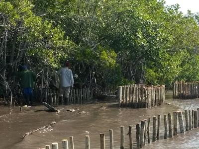
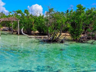
The main island of Cuba is the largest island in the West Indies, with a total land area of 104,945 km². The total area of the country as a whole, including the Isla de la Juventud (2,200 km2) and around 4,195 keys and small islands, is 110,860 km2. The country lies between latitudes 20º 12' 36'' and 23º 17' 09''N and longitudes 80º 53' 55'' and 84º 57' 54''W. The topography is mostly flat to rolling, with rugged hills and mountains in the southeast and south-central area. The Cuban mountain range system is formed by four massifs covering 1,959,400 ha, equivalent to 18% of the surface of the Cuban archipelago. The surface cover of Cuba consists of cropland and crop/natural vegetation mosaics (44%), shrub lands, savanna and grasslands (24%), forests (23%) and wetlands (9%) (Earth Trends, 2003).
Active Projects

Projects Completed
Latest Updates
See all


Latest Publications
See allThis issue of the NDC Insights series (published March 2025) focuses on adaptation and the critical alignment between National Adaptation Plans…
