The Union of the Comoros is an archipelago composed of four islands which are, from East to West: Mayotte (370 sq km), Anjouan (424 sq km), Mohéli (290 sq km) and Grand-Comoro (1148 sq km). In spite of the accession of the country to international sovereignty in 1975, Mayotte is still under French rule. Therefore, this document refers to the three islands only.
The country is located at the northern entry of the Mozambique Channel between Madagascar and the Eastern coast of Africa, thus occupying a strategic position. The islands are separated from deep sub marine channels. The total area of the three islands, which form the Union of the Comoros, is 1862 sq km.
The Comoro archipelago is exclusively of volcanic origin. On the geo-chronological plan, the latest information on the age of the three islands is respectively as follows: 1.49, 0.48, 0.36 millions years (Ma) for Mayotte, Mohéli and Anjouan (Armstrong, 1972: Emerick and Duncan, 1982, 1983: Nougier and al, 1986) and 0, 13 Ma for Grand-Comoro (Emerick and Duncan, 1982, 1983). The island of Grand Comoro is composed of two volcano shields represented by the massif of the Northern Grille in the North and the massif of the Karthala in the South. The latter is still active. The 1977 eruption affected the village of "Singani" in the southwest of the island. The latest eruption dates back to November 2005.
The volcanoes that constitute the islands of Mohéli and Anjouan have reached a more advanced maturation stage and are deeply eroded. Mayotte presents a more advanced evolution stage, which is still characterized by erosion and a very intense alteration. The three islands are affected by two systems of fracture, towards North-West/South-East and North- South. At the local level, as in Anjouan and Mohéli, some signs of subsidence can be noted in Foumbouni and Malé in the Southeast, the oldest risen part of Grand-Comoro. Close to Mitsamiouli in the North-West of Grand-Comoro and Malé, the reef is splitting to give birth to the beginning of a reef-barrier.
The coastal and marine environment offers a great variety in its morphology (low coasts, cliffs, islets, platinum…) and in its nature (lavas, white or black sand beaches, stones, blocks, coral cliffs). Generally speaking, the continental plateau (900 sq km) is highly reduced in the west of the archipelago where the seabeds have suddenly reached depths higher to 3000 meters due to the existence of a North-South rift along the Mozambique Channel. The narrow plateau accounts for the low development of coral reefs. In the East, the seabeds are less deep and are the extension of the Madagascar continental plateau.
Active Projects


Projects Completed
Latest Updates
See all


Latest Publications
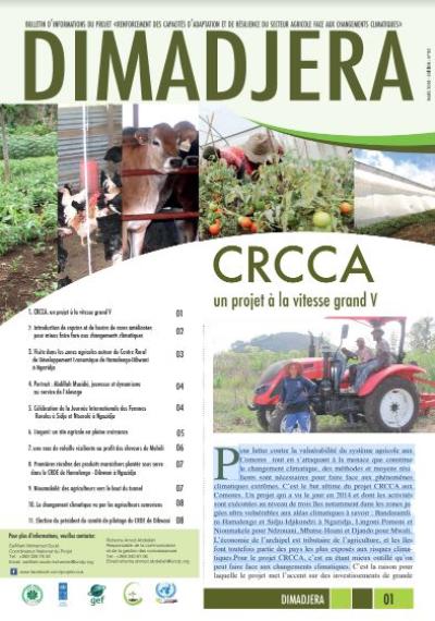
See allPour lutter contre la vulnérabilité du système agricole aux Comores tout en s’attaquant à la menace que constitue le changement climatique, des…