Agriculture sector decision makers identify best practices for boosting resilience through peer-to-peer exchange in Philippines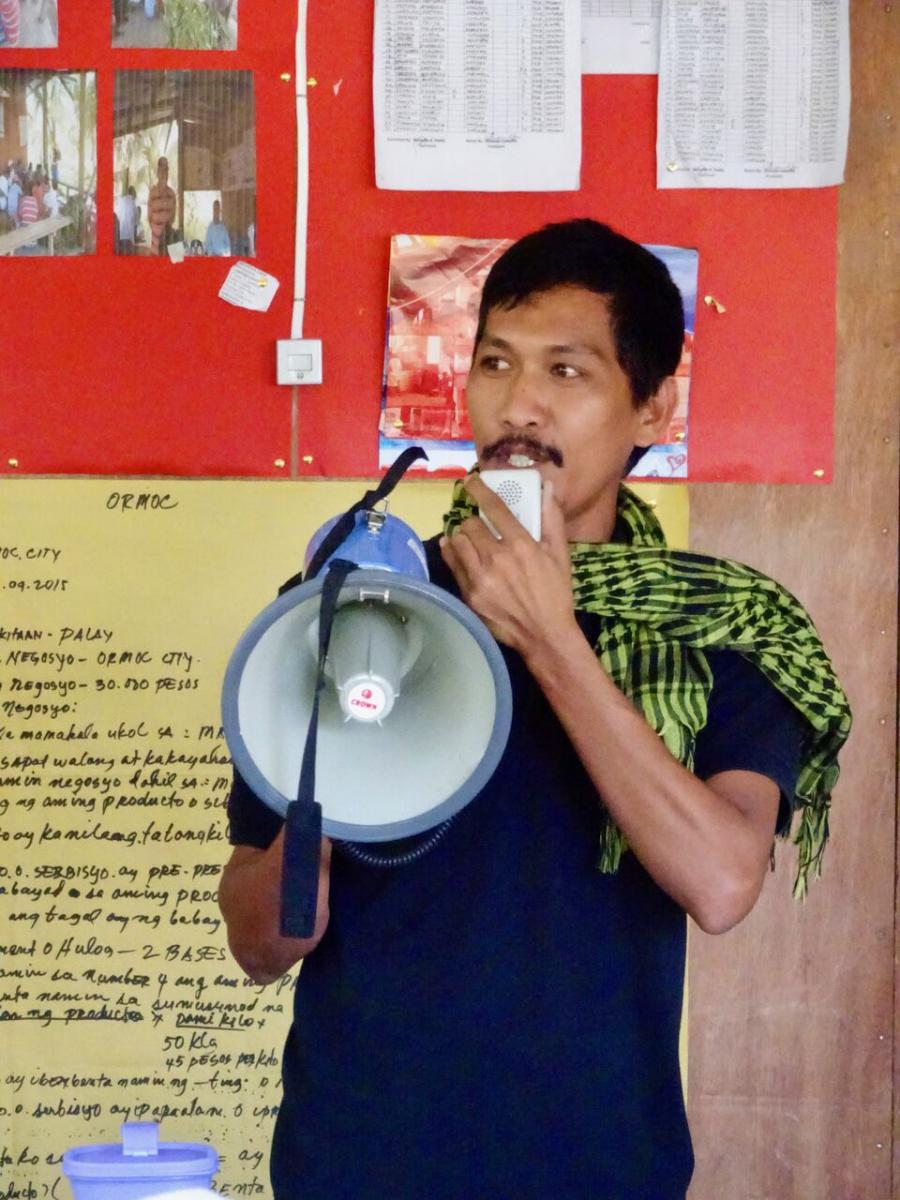
June 2017, Cebu, Philippines – Understanding the weather and climate – when storms will break, how much rain will fall, and when the rainy season will start and end – are one of the most valuable tools a smallholder farmer can possess. But what happens when the climate changes and age-old traditions are put on their end?
What happens when drought wipes out crops and washes away new irrigation pumps and maybe even a few prized pigs? What happens when bad decisions are made on bad data? And when poor farmers, without viable access to insurance or other risk reduction mechanisms, are left to fend for themselves?
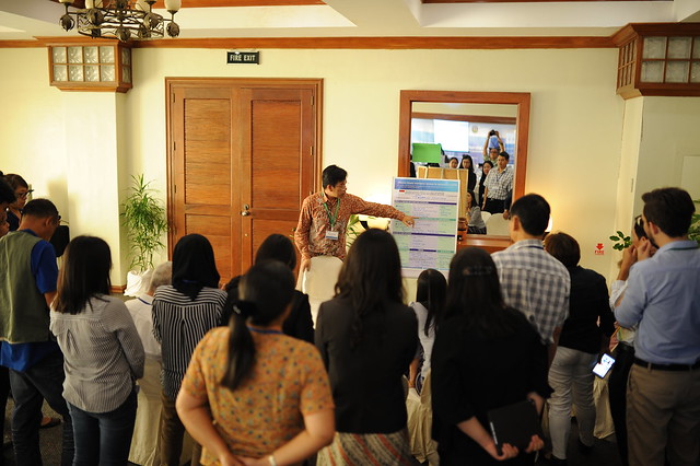
These are the very real challenges and truths behind climate information and early warning systems and how they relate to more effective National Adaptation Plans. At a recent peer-to-peer exchange on “Effective Climate Information Services for Agriculture in ASEAN” a number of best practices were uncovered in a world café-style marketplace that highlighted how various countries in Asia and the Pacific are using climate information to inform better decision making, and keep the family pigs from being washed away when floods hit. These peer-to-peer exchanges bring together ministries of agriculture, environment, applied research institutes as well as development partners.
Fifteen members of the collaborative UNDP-FAO Integrating Agriculture in National Adaptation Plans (NAP-Ag) Programme from Nepal, the Philippines, Thailand and Viet Nam – as well as FAO and UNDP experts – participated in the exchange. There were also participants from other development partners, including GIZ, APEC Climate Center, and the Consultative Group for International Agricultural Research. The NAP-Ag programme is funded through the German Federal Ministry for the Environment, Nature Conservation, Building and Nuclear Safety.
The main focus of the workshop was to generate actionable learning and collaboration activities that participants could then use to promote the effective provision of climate information services into National Adaptation Plans. 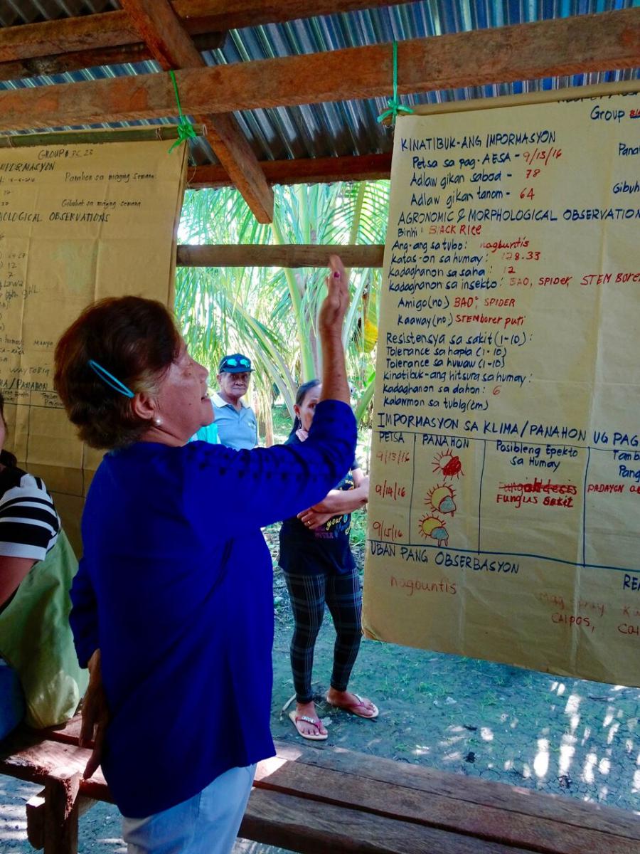
The application of new and innovative technology has significantly improved the production, transformation and delivery of climate information services. These services range from near-term weather forecasts, watches and advisories, to participatory approaches that put actionable seasonal forecasts and longer-term climate projections into the hands of farmers, decision makers and other vital stakeholders.
This information can both inform National Adaptation Plans (NAPs) and improve the integration of agriculture into NAPs outputs. Despite advances, however, implementation barriers remain – particularly a lack of institutional mechanisms, proper data capture and dissemination, and local capacity to provide farmers with timely and relevant information.
Best practices shared in the exchange point to new opportunities to cross the last mile with effective climate services and support the effective integration of agriculture into National Adaption Plans with improved data, better risk reduction mechanisms and increased sharing of information.
Climate resilient water management in Thailand
In Thailand, climate information services on water management are delivered through a central data management system via a media box to local extension agents. The information and climate and weather models are also available through a website and mobile application.
“Many Government agencies are working on Climate Information Services (CIS). One of the best practices I learnt from Thailand is to create mobile applications and replicate these from the national to sub-district level, meaning localizing CIS,” said Joseph Basconcillo of the Philippine Atmospheric Geographical and Astronomical Services Administration (PAGASA).
By connecting extension and advisory services that can interpret climate information and help farmers decide when to plant, when to harvest and when to get out of harm’s way, the Thai Water Service is more effectively sharing climate data with end users. Government agencies like the departments of meteorology, public utilities, hydrology, geography, disaster risk, and economy and society also have access to the information, which could lead to better planning on a variety of adaptation initiatives, from when and how to use hydro power, to better crop rotations and improved planting schedules.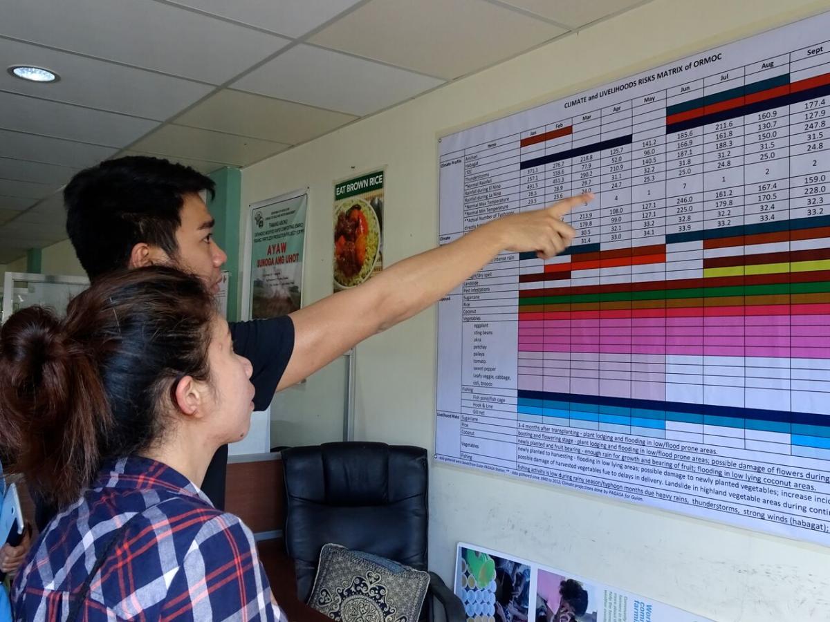
“I especially liked the Thai case on climate-resilient water management, where 34 different government agencies which have water information contribute to one data center. This gets analyzed and translated into advisories depending on the target audience. I hope we can apply it in the Philippines,” said Alice Ilaga, Director of the System Wide Climate Change Office of the Philippine Department of Agriculture.
Improving climate literacy in Indonesia
Change isn’t always easy. In Indonesia, improved climate information services are providing wet and dry seasonal onset forecasts, dry-spell monitoring, monthly rainfall info, drought indexes, food security bulletins and more. But getting farmers and decision makers to use this data, and scale-up the successes of pilot initiatives that have shown improved productivity is a challenge that will need to be addressed.
Raw climate data is hard to understand. In the case of Indonesia, translation of climate information data into actionable agro advisories aids the Ministries of Agriculture, and Environment and Forestries in making decisions based on good climate intelligence.
“Data is everything… The collaboration between every related organization is also very important. There is also a need to involve community organizations if you want to succeed,” said Jittiporn Chantarojsiri of Thailand’s Hydro and Agro Informatics Institute.
Farmers attending climate school in Laos
In Laos, crop calendars are being shared with smallholder farmers, who can then use the information to decide which varieties of rice to plant and how to deal with plant diseases. Field schools help farmers understand and act on the data. Farmers in Laos also work to write down weather events, serving in part to supplement data-gathering for other climate information.
“Growing crops is relatively influenced by weather conditions. Farmers will lose when they don’t have the ability to predict when to plant... This would contribute to improving productivity and livelihoods and in doing so, we can sustain food productivity and production for our people,” said Abel Wagas of the Philippine DA-Adaptation and Mitigation Initiative in Agriculture (AMIA).
Finding the right channel at the right time in Viet Nam
With better climate information, farmers in Viet Nam are able to improve net income for rice by US$40 per hectare. That’s a really good thing. One challenge is the information provided is largely derived from satellite data, rather than locally sourced data that would come from a system of local hydromet observation sites and provide a more granular picture of the micro-climatic situation on the ground.
Mobile-based platforms certainly have potential here – for instance 80 to 90 percent of farmers targeted under CIS programmes used mobile platforms – but systems still need to be put in place to better connect climate information with extension workers.
One interesting piece from Viet Nam is how people use this information, how they share it, and the relative value they place on good climate intelligence. For starters, farmers are willing to pay for this data, adding the potential for more public-private partnership to deliver extended climate services. Women also are known to share climate information in market areas, pointing to the possibility of yet another way of more effectively sharing this information across vulnerable communities.
“From the ICRAF (Agro-Forestry Institute) project on agro-climate information services for women and ethnic minority farmers in south east Asia, [including Viet Nam], one thing that struck me the most was that households were willing to pay for the translation of climate information. I think it is a good business model that can be replicated,” said Ms. Antonieta Arceo from the Department of Agriculture – Agricultural Training Institute (DA-ATI).
Sharing climate services to increase profits
Investment in climate and weather services is a smart use of money. Generally, it is thought to have at least a 5:1 return on investment. In Cambodia, improved climate information in pilot projects – including sharing of daily, monthly and yearly forecasts, and improved national policies for rice production – increased income by around 69 percent. On the ground, agro-advisories were delivered through extension services, NGOs, TV, radio and cell phones, farmer field schools and demonstration plots.
Managing data in Myanmar
In Myanmar, a web-based platform is being developed to generate and disseminate agro-meteorological bulletins based on short and medium-range weather. The dissemination does not stop there. Improved 15-day agro-met bulletins are then shared with agricultural journals and through other channels to ensure stakeholders on the ground are well informed.
Improved Data Collection and Sharing in The Philippines
In the Philippines a network of nearly 1,000 Automatic Weather Stations (AWS) – installed and maintained through innovative public-private partnerships – is looking to provide the 100 million people of this island nation with free, accurate and localized weather information that can be used to save lives, build resilience and improve livelihoods.
With this improved information, weather-based index insurance is now a viable option to lower risk on the farm. Extension of climate services through media partnerships in the Philippines aids in the distribution of climate information.
In the area around Ormoc for instance, typhoons have caused major devastation, with millions of losses and thousands of dead. The city is improving its climate intelligence with localized climate information, that allows for the translation of hard-to-understand weather and climate information. The improved info also helps farmers shift toward organic production, select species to plant based on maturation times and timed out to meet seasonal rain fluctuations. These species also consume less water.
Through climate resilience field schools (CRFS), the city is integrating climate information into the trainings provided to farmers. At the Margen Farmers’ Association (MARFA), localized information is provided online by PAGASA every week. Farmers can combine this with agro-morphological observations as well as indigenous knowledge, which has made a significant difference in the management of their crops. The yield has grown by more than two thirds thanks to the improved information as well as the increased use of organic fertilisers through the CRFS. They can also use less water and prevent fungal infection.
Photo captions: Top - Climate data is also shared via loud speaker, ensuring illiterate people also have access to this information. Middle - Improved sharing of climate information is helping rice production in The Philippines. “Ormoc is focused on localized agriculture so it’s crucial that information be directly given to farmers,” said Richard Gomez, the Mayor of Ormoc. Bottom - “Many Government agencies are working on Climate Information Services. One of the best practices I learnt from Thailand is to create mobile applications and replicate these from the national to sub-district level, meaning localizing CIS,” said Joseph Basconcillo of the Philippine Atmospheric Geographical and Astronomical Services Administration (PAGASA).
Learn More