
Lesotho is a mountainous, landlocked country located in Southern Africa, prone to natural disasters, and liable to drought and desertification. The country is already paying high premiums as a result of the impacts of global warming. This is evidenced by the increasing frequency of natural disasters, devastating droughts and emerging signs of progressive desertification.
The fragile soil/terrain characteristics, erratic climatological conditions, difficulties of realizing the full potential of agro-ecological conditions, the growing level of poverty which is currently estimated at more than 50 percent of households, and the relative deprivation of the inaccessible mountain region (which makes up more than 60 percent of the country), ranks Lesotho as one of the most highly vulnerable developing countries.
In response to those vulnerabilities, this 6-year project (2015 - 2021) sought to mainstream climate risk considerations in the Land Rehabilitation Programme of Lesotho for improved ecosystem resilience and reduced vulnerability of livelihoods to climate shocks through i) Knowledge, skills and institutional capacity support land rehabilitation programme to factor in additional risks from climate change, increase resilience and reduce vulnerability; and ii) Climate change adaptation mainstreamed into local and regional development planning and finance.
- Community
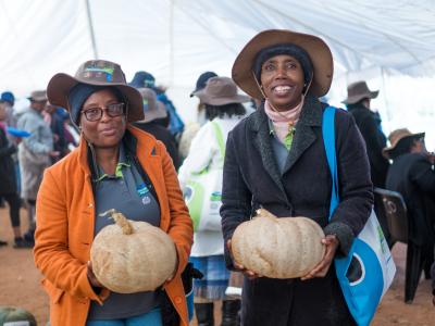
The project aims to reach approximately 7,000 households in Lesotho's Foothills, Lowlands and the Lower Senqu River Basin.
- Lesotho Ministry of Forestry and Land Reclamation
- United Nations Development Programme (UNDP)
- Global Environment Facility (GEF)
The population of Lesotho is estimated at 2 million people (1996 census) a majority of which earns their livelihoods from agriculture. Many Basotho (Lesotho's majority ethnic group) pursue rainted agriculture and are thus highly vulnerable to climate change and variability. The agricultural sector accounts for about 10 percent of the country's gross domestic product (GDP). It's the primary source of income - as well as an important supplementary source of income - for more than half of the population. The agricultural sector is subject to multiple shocks and stresses that increase household vulnerability. Climate change is one of the pervasive stresses that rural communities have to cope with. The situation is worsened by declining employment opportunities and rising staple food prices that adversely affect household resilience to the shocks brought by climate change.
The project will increase the effectiveness of the baseline being invested by the government on land rehabilitation and policy implementation (related to rangeland management and rural development), by increasing the resilience of the natural resources and ecosystems to climate-induced disasters; thereby reducing the vulnerability of the people dependent on these resources to climate variability and change. The LDCF portion of the project will finance the additional costs of maintaining natural assets and related agro-ecological and hydrological services essential to sustaining the productivity of the natural resources in the face of climate change. Community and District Councils will also be assisted to mainstream climate change considerations into local development strategies. Additionally, training communities to rehabilitate and manage ecosystems in a climate-smart manner will increase their resilience to climate shocks as well as improve their livelihoods through greater income-generating opportunities. Without the project, local communities and the ecosystems upon which they depend will be increasingly at risk from the impacts of climate change.
The project will also provide practical tools, technologies and capacities for an adaptation programme that promotes ecosystem management by communities. This will be done through practical demonstrations over 50,000 ha to improve the maintenance and enhancement of ecosystem functioning, integrity and resilience. At least 7,000 households in the Mohale’s Hoek District will directly benefit from LDCF resources. These benefits will accrue because improved soil quality and ground cover will lead to increased water infiltration and reduced run off, as well as a decrease in soil erosion. These benefits include: i) improved water quality; ii) increased groundwater recharge; iii) reduced surface water runoff during intense rainfall events; and iv) mitigating the impact of extreme weather events and natural disasters. The combined effect of improved soil and vegetation cover will also increase rangeland productivity. In addition, rehabilitation of degraded rangeland and wetland ecosystems would increase the potential for local communities to increase or diversify household income by supporting alternative livelihoods generated by ecosystem goods and services. The development of sustainable alternative livelihoods would reduce the pressure placed on natural resources by traditional livelihood practices such as agriculture, thereby increasing the climate resilience of vulnerable communities in Lesotho. Strengthening the livelihood assets on which communities depend – such as rangelands – safeguards household income as households are less prone to – and in a better position to recover from – climate-induced disasters. In addition, the project will upscale the lessons learned to enable replication elsewhere in Lesotho.
Source: Lesotho UNDP Project Document (November 26, 2014), Lesotho - International Food Policy Research Institute, and Lesotho - National Report on Climate Change
Outcome 1. Increased technical capacity of the Ministry of Forestry and Land Reclamation and relevant departments to apply up-to-date climate science for the management of evolving risks and uncertainty linked to climate science.
A geo-based climatic, agro-ecological and hydrological information system will be implemented to support better planning for climate change adaptation under the Land Rehabilitation Programme (Output 1.1), so will a socio-economics unit in the Ministry of Forestry and Land Reclamation (Output 1.2). Climate-driven vulnerabilities in the Lithipeng, Khoelenya and Thaba-Mokhele Community Councils and cost-benefit analysis of specific adaptation interventions will be assessed (Output 1.3). And technical guidelines for these climate change adaptation interventions will also be established (Output 1.4).
Outcome 2. Communities empowered with skills, knowledge, partnerships and institutions for managing natural resources to reduce vulnerability to climate change and increase resilience of natural and social capital.
Training of technical staff of the District Technical Teams, Community Council staff and land managers on restoring and managing ecosystems and agro-ecological landscapes using a climate-smart approach (Output 2.1), as well as training of engineering, planning and monitoring sections of the MFLR on climate science will be done (Output 2.2). Local community members farmers, pastoralists and rural households) from Lithipeng, Khoelenya and Thaba-Mokhele Community Councils will be trained in construction and maintenance of climate-smart ecosystem rehabilitation and management interventions (Output 2.3). An operational inter-council land rehabilitation committees operational in Lithipeng, Khoelenya and Thaba-Mokhele Community Councils will be established (Output 2.4), so will a strategy for maintaining technical capacity in the MFLR and relevant departments (Output 2.5).
Outcome 3. Over 50,000 ha of land across the Foothills, Lowlands and the Lower Senqu River Basin rehabilitated through operationalization of the climate-smart Land Rehabilitation Programme.
Climate-smart ecosystem rehabilitation and management interventions in Lithipeng, Khoelenya and Thaba-Mokhele Community Councils implemented, including: i) protection of critical fens and bogs; ii) adoption of conservation agriculture and agro-forestry practices; and iii) strategic interventions in sensitive areas, including construction of check dams and rehabilitation of old gulleys and rills (Output 3.1). A long-term strategy for monitoring and evaluating climate-smart ecosystem rehabilitation and management interventions for the MFLR and relevant departments, including an experimental design to evaluate the impact of interventions using grass cover as a proxy for rangeland productivity will be established as well (Output 3.2).
Outcome 4. National strategies for rangelands and wetlands management strengthened by the integration of climate change/variability and ecosystem management.
Policy guidelines for incorporating climate science in the review/formulation processes of national sectoral strategies established by the Departments of Rangelands Management and Water Affairs (Output 4.1).
Outcome 5. NSDP mainstreamed into local development strategies to support the constituency-wide adoption of the climate-smart Land Rehabilitation Programme.
Strategy for improved coordination between regional and district development teams to reduce vulnerability to extreme climatic events in the Foothills, Lowlands and Lower Senqu River Basin established (Output 5.1). Revised local policies across productive sectors set up – particularly agriculture, infrastructure development, and rural development – include identified best practices for climate-smart interventions (Output 5.2). Policy recommendations for the integration of climate risk considerations into the Lithipeng, Khoelenya and Thaba-Mokhele Community Councils’ development plans, as well as the Mohale’s Hoek District development plan established (Output 5.3). Training on climate-resilient construction, climate-smart land use and water resource planning, and climate risk management for the relevant officials. Trained staff will include: structural engineers; urban and rural infrastructure planners; local authorities; district planning units; officers of the Ministry of Development Planning; and teaching staff from technical colleges and vocational training institutes (Output 5.4). Best practices and documentation on climate-smart land management in the Lithipeng, Khoelenya and Thaba-Mokhele Community Councils disseminated through existing national and international platforms (Output 5.5).
Source: Lesotho UNDP Project Document (November 26, 2014).
Project monitoring and evaluation (M&E) will be in accordance with established UNDP procedures and will be carried out by the Project team and the UNDP Country Office. Periodic monitoring of implementation progress will be undertaken by the UNDP-CO through quarterly meetings with the project proponent, or more frequently as deemed necessary. This will allow parties to take stock and to troubleshoot any problems pertaining to the project in a timely fashion to ensure smooth implementation of project activities.
The budgeted M&E activities and timeframe are as follows:
Inception Workshop and Report (Within first two months of project start up); Measurement of Means of Verification of project results (Start, mid and end of project during evaluation cycle) and annually when required); Measurement of Means of Verification for Project Progress on output and implementation (Annually prior to ARR/PIR and to the definition of annual work plans); ARR/PIR (Annually); Periodic status/ progress reports (Quartly); Mid-term Evaluation (At the mid-point of project implementation); Final Evaluation (At least three months before the end of project implementation); Project Terminal Report (At least three months before the end of the project); Audit (Yearly); Visits to field sites (Yearly).
Source: Lesotho UNDP Project Document (November 26, 2014).