Surprisingly, until now, detailed and accurate measurement of land height has not existed for the majority of atoll islands in the Pacific region, a crucial missing piece of the puzzle when it comes to understanding — and responding to — sea level rise. Now, new data collected via state-of-the-art LIDAR, or Light Detection and Ranging, technology, sheds a light on the challenges in one of the world’s most threatened nations — Tuvalu, with implications for other small island developing states around the world.
If you’ve been following the news related to COVID-19, you will have heard the mantra “testing, testing, testing”. The understanding is, if we don’t know how the virus is spreading, how can we possibly contain or manage it?
When you think about it, the same logic applies to climate change – how can we possibly respond to its impacts, when we don’t know what is happening?
Of course, we (the global community) have known empirically for decades that the planet is warming and that this warming is having a host of consequences, from more frequent extreme weather events to rising sea levels to warming and acidifying oceans. The science is clear and compelling.
We have also been aware for years that atoll islands are very low and threatened by sea level rise. But in this case, our understanding has been much less precise.
In fact, it might surprise you to know that until now, detailed and accurate measurement of land height has been not existed for the majority of atoll islands in the Pacific region.
Climate crisis in the Pacific
In the Pacific, we know with high confidence that sea level rise is climbing at a rate of centimetres over decades.
The outlook is very serious for low-lying atoll countries as the sea increasingly erodes shorelines, contaminates fresh water sources, and harms critical subsistence food crops such as coconuts, breadfruit trees, banana and taro.
Building resilience is an urgent priority for countries like Tuvalu, where most land, communities and infrastructure are located near the shore and on land barely above sea level.
Tapping state-of-the-art technology in Tuvalu
Launched in 2017, with backing from the global Green Climate Fund and in partnership with the United Nations Development Programme, the Tuvalu Coastal Adaptation Project aims to reduce exposure to coastal hazards and to develop a long-term coastal adaptation strategy for the country.
One of the first and most fundamental tasks of the project has been to secure baseline data to elucidate the relationship between land elevation and sea level, to model future scenarios, and to inform design of coastal infrastructure, as well as development planning.
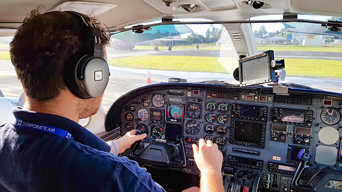
To gather the data, the project last year turned to airborne LIDAR, or Light Detection and Ranging – state-of-the-art airplane-mounted technology which can rapidly collect precise information on land surface height and sea floor depth.
The survey plane captures aerial photographs of unprecedented accuracy and clarity, and when combined with the LIDAR data provide a very powerful 3-dimensional tool for use in hazards management.
These products are fundamental to the understanding of marine hazards and are also used to analyse coastal processes, sea level rise, storm wave inundation, sediment movement, and to identify low-lying flood zones. (They also have a range of development uses too such as resource management, conservation, safe navigation, adaptation and development planning.)
A revolution in our understanding
From one survey completed under the project, we now have 100 percent coverage of all of Tuvalu’s nine atoll systems and all of the islands and surrounding reefs and lagoons – around 500 square kilometres in total. Pretty impressive.
An individual home can now easily be identified and its location in relation to the shore and to sea level instantly measured.
It is indeed a historic advance in our understanding, with implications for Tuvalu’s future but also for our understanding more broadly about coastal vulnerability and development priorities in atoll countries around the world.
Analysis of the data is progressing, but in just one example, we now know that during highest measured sea levels, 46 percent of the central built area of Fogafale is essentially below sea level – a fact which directly substantiates Tuvalu’s reports of ever-increasing flooding due to sea level rise in their capital.
The data is already being put to numerous uses.
Þ The project has used the data to directly brief outer island Kaupule (councils) about safer flood-free zones for building.
Þ The Government has integrated the data into its national recovery and vulnerability reduction plan for Tropical Cyclone Tino (which by official estimates severely affected more than half the population last January and led to a State of Emergency).
Þ The data will be incorporated into navigation charts, crucial for safe ship operations and trade (presently there are no updated charts for Tuvalu since the mid 1980s).
Þ The Department of Lands and Survey is using the data as its baseline for planning and has also incorporated it into its maritime boundaries work.
Þ The UNDP-supported Ridge2Reef project is drawing on the data to support reef conservation work.
Þ A World Bank-backed project improving the climate resilience of Nanumaga’s harbour and Funafuti’s port is looking at using the data in their risk modelling around the impacts of storm surges.
Most importantly, the Government of Tuvalu is now basing their long-term adaptation strategy, including bold land reclamation plans, on the data collected.
“The LIDAR data collected by the Tuvalu Coastal Adaptation Project has provided the Department of Lands with the best possible coverage for development planning. In fact, the data is valuable across government departments, providing a tool for adaptation, development, resource management and environmental monitoring needs linked to climate change. Further, it has given us baseline information for each of Tuvalu's island — enabling us to compare with the past and to model the future.” – Mr. Faatasi Malologa, Director of Tuvalu’s Department of Lands and Survey
The products we get from the LIDAR survey are truly a game changer, informing all aspects of development, including infrastructure planning and adaptation.
In the fight against climate change, data is an incredibly empowering tool
Like COVID-19, without testing or measuring, the impacts of climate change are hard to grasp.
By testing and measuring, we quantify and bring the problems into sharp focus. Most importantly, it means we can better understand timelines and solutions, and therefore can respond more effectively.
With the new LIDAR data, there is state-of-the art science showing the tenuous nature of these islands under accelerating sea level rise and climate change – and the necessity of re-doubling adaptation support.
Following their success, other Pacific countries are now looking to Tuvalu.
The Tuvalu Coastal Adaptation Project is a 7-year project implemented by the United Nations Development Programme in close collaboration with the Government of Tuvalu and funding from the Green Climate Fund. For more information, please visit https://tcap.tv or contact Regional Technical Advisor for Climate Change Adaptation at UNDP, Aishath Azza aishath.azza@undp.org
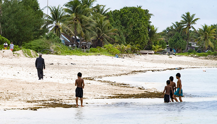
UN Secretary-General António Guterres walks on the beach as children play in the ocean. Guterres visited the country as part of a Pacific trip to spotlight the issue of climate change ahead of the global Climate Action Summit in September 2019. © UN Photo/Mark Garten
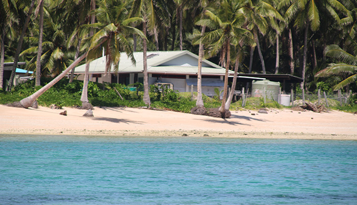
Nanumea island 2020 © Puanita Taomia Ewekia/TCAP-UNDP Pacific Office in Fiji
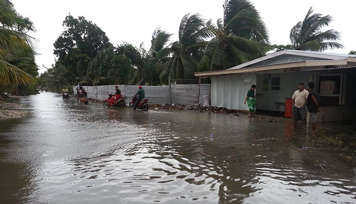
Fogafale during Cyclone Tino, January 2020 © Puanita Taomia Ewekia/TCAP-UNDP Pacific Office in Fiji
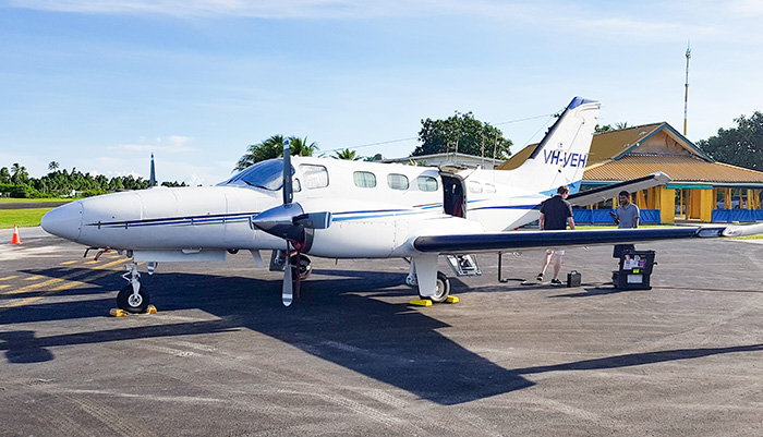
Readying for take-off, January 28 2019. © Arthur Webb/UNDP
Readying for take-off, January 28 2019. © Arthur Webb/UNDP
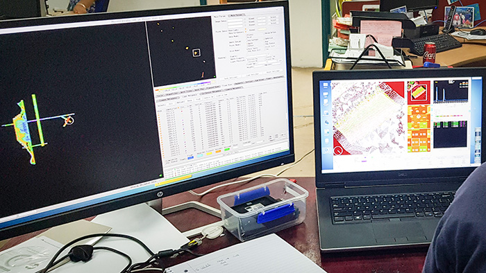
Reviewing the data on return to the Lands and Survey Department © Arthur Webb/UNDP
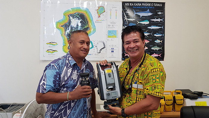
Faatasi Malologa, Director of Tuvalu’s Department of Lands and Survey with Alan Resture, TCAP Project Manager © Puanita Taomia Ewekia/TCAP-UNDP Pacific Office in Fiji
Story by Kate Jean Smith, Communications Specialist, Climate Change Adaptation, UNDP. Tw: @K_Jean_https://twitter.com/k_jean_
Related articles
‘Advanced Topographic and Bathymetric Survey to Support Tuvalu’s Adaptation Efforts’, UNDP Pacific, April 24 2019
‘SPC and UNDP partner to support coastal adaptation in Tuvalu’, December 2018
‘Tuvalu’s climate resilience shored up with launch of US$38.9 million adaptation project’, August 30 2017
Video: ‘Building resilience to climate change in the Pacific: Tuvalu Coastal Adaptation Project’ (2:01) June 2020