

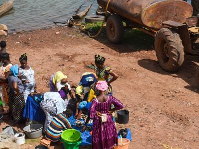
In Guinea-Bissau the impact of those changes were already being felt in the economy for some time, especially due to a diminishing rainfall and the gradual rise in temperature. In terms of water resources, this can be seen in aquifers that have decreasing quantities of water and are more easily flooded by salt water, ground waters increasingly deeper and dried-up lakes; concerning the agrarian sector, production of Guinean staple food (rice), has diminished markedly, also due to the salinity and acidity of hydromorphous soils and the flooding of rice fields.
Due to the fact that climate changes exert a negative influence on the quality and quality of water resources through a reduction in rainfall. 14 projects were chosen in order to achieve these strategic objectives including those on the Diversification of Food Production and the Improvement in the Supply of Potable Water in Rural Areas.
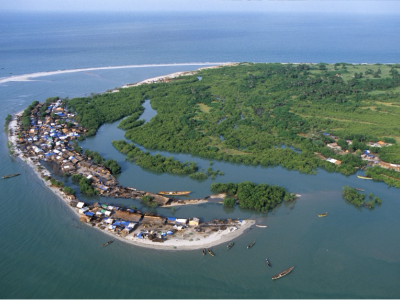
Guinea-Bissau is situated on the West African coast (latitude 10º 59' N, between 13º 38´ and 16º 43´ W meridians). It has a surface of 36,125 kmÇ, maximum latitude of 193 km and a maximum longitude of 330 km. The country has common borders with Senegal to the north and Guinea-Conakry to the south and east, and has the Atlantic Ocean to the west. Its territory is divided into a continental zone and an insular one, the latter being constituted of a contiguous chain of islands - Jeta, Pecixe, Areias, Caiar, Como e Melo and the Bijagós archipelago, made up of 88 islands and islets of which only 21 are inhabited.
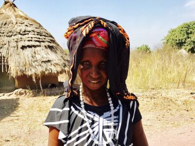
Participatory evaluations of vulnerability and adaptation carried out under NAPA preparation and based on various sector studies-diagnoses, revealed that the sectors that ensure means of subsistence to the overwhelming majority of Guineans and that constitute the basis variability in weather patterns, namely: the agrarian sector (agriculture, forests and livestock), water resources, fisheries and public health.
Active Projects

Projects Completed
Latest Updates
See all


Latest Publications
See allThis NAP in focus country briefing on the process to formulate and implement National Adaptation Plans in Guinea Bissau considers firstly the…
